


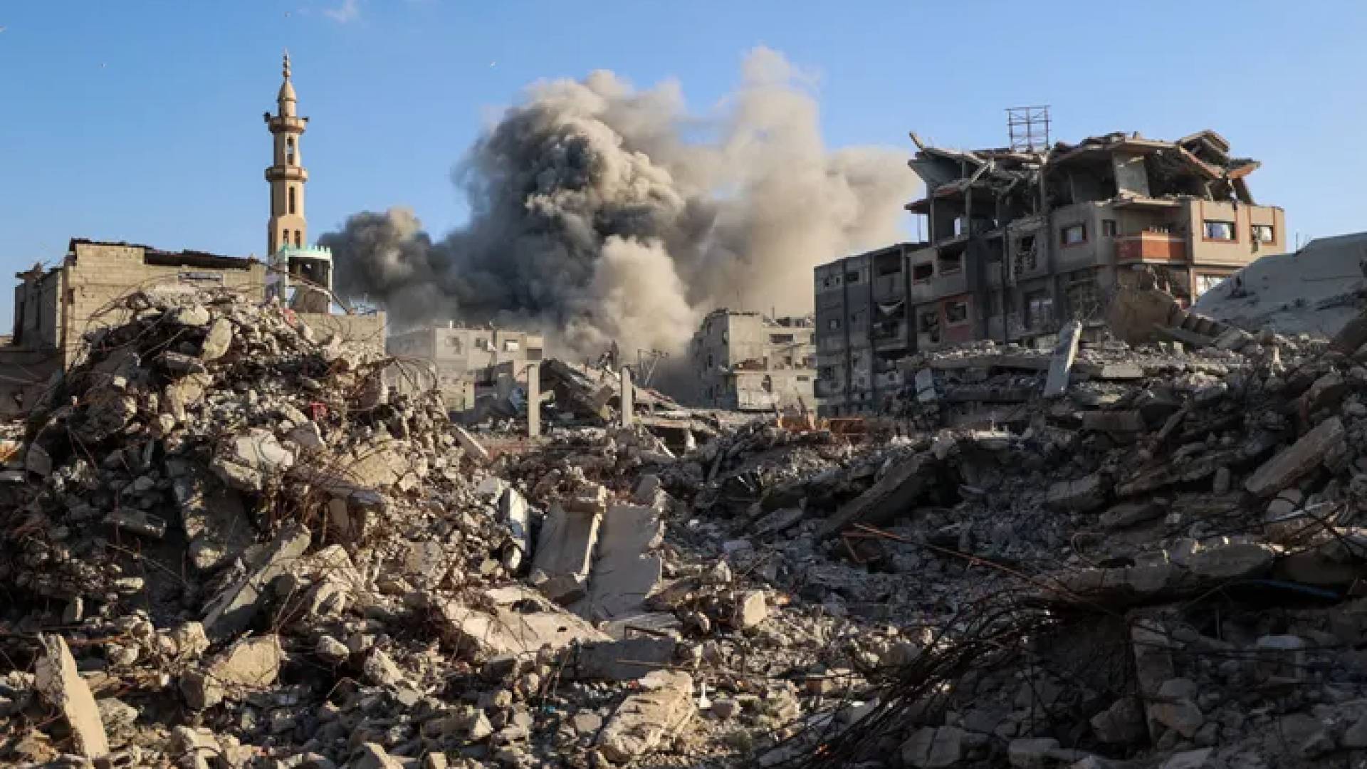
The Palestinian Nakba in 1948 was not merely a fleeting military or political setback, but a radical transformation that reshaped geography, people, and memory. The Israeli occupation imposed a new reality that turned a network of thriving cities, villages, and plains into a map of ruins, camps, and distant exiles.
Recent data issued by the Palestinian Central Bureau of Statistics on the occasion of the 78th anniversary of the Nakba indicate that the Palestinian presence has numerically doubled despite the uprooting. The number of Palestinians worldwide reached about 15.5 million by the end of 2025, distributed between inside Palestine and the diaspora.
Statistics show that 7.4 million Palestinians remain steadfast within the borders of historical Palestine, while 8.1 million live in diaspora countries and exiles. These figures reflect the continuity of the issue and its geographical expansion, which the occupation has failed to obliterate over decades of displacement.
Before the catastrophe, the Palestinian village represented an integrated economic and social unit of life connected to the land, seasons, and water springs. The destruction of these villages was not merely an attack on stones, but an attempt to tear apart the social fabric, relationships, and professions associated with the original place.
The Institute for Palestine Studies, in its historical publications, documents more than 400 Palestinian villages that were completely destroyed or forcibly emptied during the events of 1948. This field documentation relies on maps, photos, and live testimonies to prove the existence that the occupation tried to erase from the official map.
With the arrival of convoys of displaced people to the West Bank, Gaza Strip, and neighboring countries, the 'camp geography' emerged as a temporary alternative that lasted for a long time. The tent, which symbolized the anticipation of a quick return, transformed due to the continued occupation into permanent residential neighborhoods carrying the names of the lost villages.
UNRWA data indicates that more than 1.5 million Palestinian refugees currently reside in 58 official camps distributed among Jordan, Lebanon, Syria, and Palestine. These camps have become strongholds of identity, where refugees redefine themselves based on their original towns from which they were displaced.
Inside the alleys of the camps, the village identity did not disappear but was reproduced in language, daily relationships, and neighborhood naming. The camp is not just a narrow geographical space, but a living social map that preserves the details of homes and fields whose keys are still passed down through generations.
Palestinian geography expanded over the decades to include distant exiles in Europe and the Americas, where Palestinians are no longer confined to their Arab surroundings. Nevertheless, exile remained an extension of the homeland, where Palestinians carry the name of their original city as an integral part of their personal identity in exile.
Recent digital initiatives such as 'Visualizing Palestine' highlight efforts to reconnect refugees with their roots through data visualization techniques. These initiatives reveal that the majority of Gaza Strip refugees, numbering 1.7 million, originate from villages only a few kilometers behind the separation fence.
In the Palestinian conflict, the map is a tool of resistance and a counter-memory against attempts at erasure and Judaization practiced by the occupation authorities. Hence, applications like 'iNakba' emerged, allowing users to identify the locations of destroyed villages and digitally retrieve their images and historical data.
Restoring the names of villages on digital and paper maps is a documentary act that resists the physical absence imposed by military reality. Every name re-established is an affirmation that the Palestinian narrative has not closed, and that the place is still alive in the consciousness of its rightful owners.
The Nakba produced a parallel geography that lives in the collective consciousness, where cities and villages remain present in stories and family names despite changes in their features. This parallel geography is what makes the question of justice and return an open demand not limited by time or superseded by field realities.
In conclusion, the Nakba maps remain open to the future, telling the story of a people who continued to redefine their place despite loss. From the village to the camp and to the diaspora, Palestine remains the compass and the living memory that refuses to submit to the logic of force and occupation.
The Nakba was not merely a military operation, but a process that affected the social structure by transforming the village from an integrated living space into a physical absence present in memory.


Share your opinion
Nakba Maps.. Transformations of Palestinian Geography from Village to Camp and Exile