


Recent Israeli data and maps have revealed the occupation army's intentions to expand its military control in the Gaza Strip, through the creation of new prohibited areas that place thousands of displaced Palestinians in direct danger. These moves come months after the ceasefire agreement reached last October, raising questions about the seriousness of adherence to the boundaries set by international understandings.
The maps, distributed to international relief organizations in mid-March, showed the existence of what is known as the 'Orange Line,' which carves out an additional 11% of the Strip's area, to join the areas already under effective occupation control behind the 'Yellow Line.' According to expert estimates, these measures mean that Israel now militarily dominates approximately two-thirds of the total area of the Gaza Strip.
Sources reported that the occupation army did not publicly release these maps but merely informed relief agencies of the necessity to coordinate their movements within these expanded zones. Israeli officials claim that these areas are intended to facilitate aid delivery and protect forces, while Palestinians view them as an attempt to solidify a permanent occupation reality under the guise of 'buffer zones.'
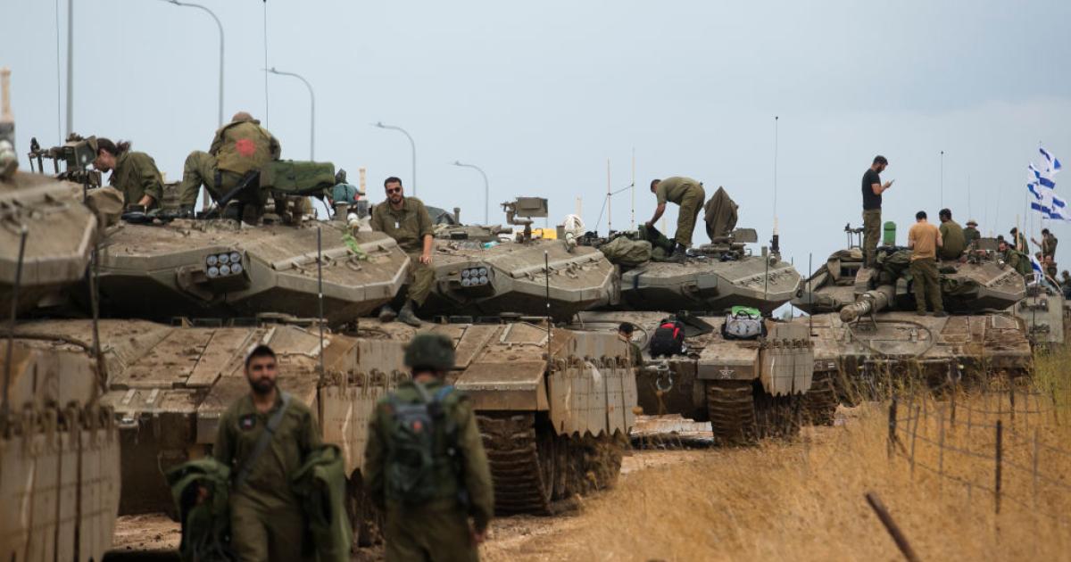
In a statement reflecting Israeli intentions, Prime Minister Benjamin Netanyahu claimed at the end of March that more than half of the Gaza Strip's territory was under full Israeli control. Netanyahu affirmed in a video statement that his army holds the initiative and surprise, emphasizing the continuation of military operations to ensure what he described as long-term security objectives.
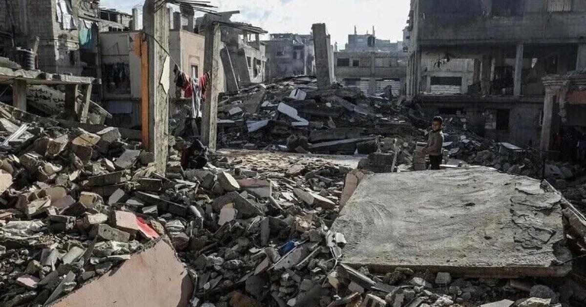
This field expansion has led to a state of severe confusion among displaced persons who suddenly find themselves within prohibited areas without prior warning. Residents of camps near Gaza City describe the situation as unstable, where military lines and borders change overnight, making them vulnerable to occupation fire at any moment.
Field reports indicate that occupation forces have killed more than 800 Palestinians since the last ceasefire announcement, most of whom fell in areas adjacent to the new military lines. These violations are concentrated around displaced persons' camps and destroyed buildings where citizens sought refuge after losing their homes during the two-year ongoing war of extermination.
The targeting was not limited to unarmed civilians but also affected international relief teams working in the field, supposedly in coordination with the occupation authorities. Three employees working with UNICEF and the World Health Organization were killed by Israeli fire in the area between the Orange and Yellow Lines since mid-March, reflecting the gravity of the operational situation.
For its part, the 'Coordinator of Government Activities in the Territories' unit justified these measures by the need to update security and operational situation assessments. The military unit claimed that defining these areas aims to protect individuals in a complex environment, but it refused to comment on the repeated changes to the maps or the extent to which Palestinian civilians were informed of these deadly changes.
Observers believe that the expansion of Israeli control casts a shadow of doubt on international political plans related to the future of the Gaza Strip, including American initiatives. Changes on the ground precede any political negotiations and impose a new geographical reality that reduces the areas available to Palestinians to their historical lowest levels.
Jad Isaac, Director General of the Applied Research Institute, confirms that the current Israeli policy aims to confine about two million Palestinians to a very narrow coastal strip where the necessities of life are not available. He explained that controlling 64% of the Strip's area makes it impossible to sustain any future Palestinian entity and pushes the population towards options of forced displacement.
Maps integrated by Palestinian researchers showed that the 'Yellow Line,' which represented the initial withdrawal boundaries, has effectively moved to include areas previously considered safe. This silent military encroachment occurs through the movement of concrete blocks and the establishment of new observation points deep within Palestinian territories, away from the eyes of the media and international oversight.
In light of this reality, fears are growing that 'buffer zones' will turn into final borders that cut off large parts of the northern and eastern Strip. Israel uses the pretext of 'security threats' to fire at any civilian movement approaching these imaginary lines that have no clear markings on the ground, turning the lives of displaced persons into a continuous nightmare.
The occupation's continued alteration of the rules of engagement and expansion of its military influence threatens a complete collapse of fragile ceasefire agreements. With the increasing number of martyrs and injured in these 'gray areas,' human rights advocates demand international intervention to stop the land grab and provide real protection for civilians and humanitarian workers.
In conclusion, the Gaza Strip remains an arena for Israeli spatial control experiments that go beyond mere military operations to the re-engineering of demographic geography. While the world is preoccupied with political disputes, Israeli mechanisms continue to draw new borders with blood and maps, threatening what remains of hope for stability in the region.
They want to confine as many Palestinians as possible into the smallest possible area to expel them, given the lack of any viability or sustainability for what remains of Gaza.


Share your opinion
New Israeli Maps Reveal Expansion of Military Control in Gaza and Confinement of Displaced Persons to Narrow Areas